Roadmap Seven: Egypt Unveils its First Comprehensive Strategy for Integrated Coastal Zone Management and Securing National Investments from Sea-Level Rise Risks.
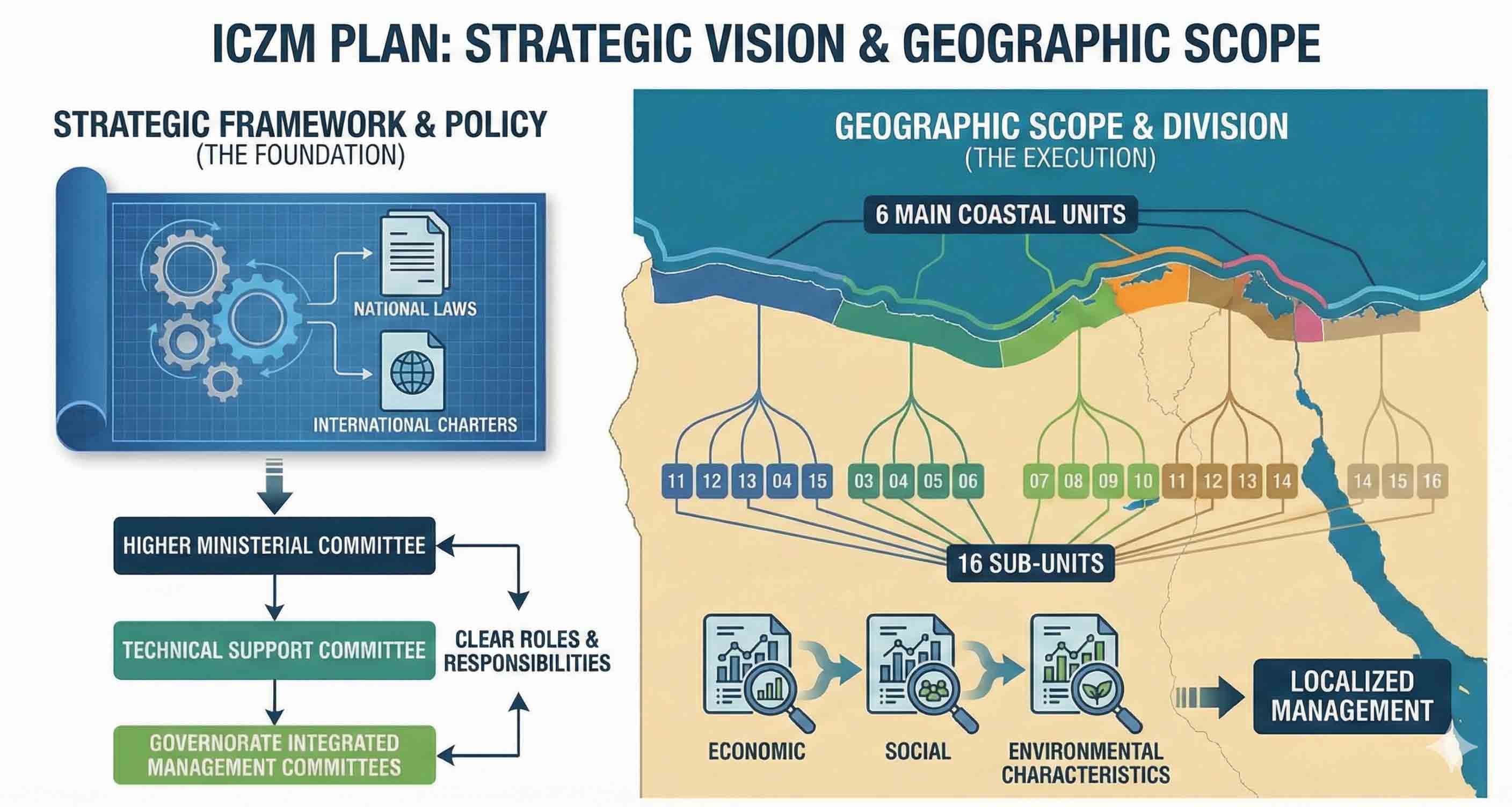
Strategic Vision and Geographic Scoping: The Integrated Coastal Zone Management (ICZM) plan establishes the foundation through a public policy framework that defines standards and strategic objectives in alignment with local laws and international conventions. This pathway involves delineating the institutional framework and precisely allocating roles among the High National Committee, Technical Secretariats, and Governorate Committees. To ensure implementation accuracy, the coastline has been geographically divided into 6 main coastal units, branching into 16 sub-units. Each unit has undergone a detailed assessment of its economic, social, and environmental characteristics to ensure localized management that is well-attuned to the specific nature of each region.
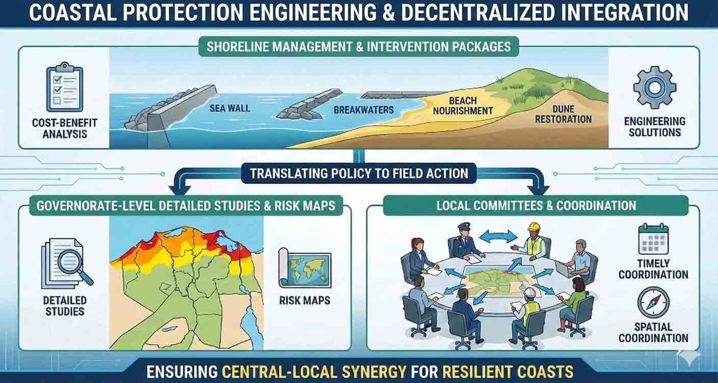
Shore Protection Engineering and Decentralized Integration with Governorates: The plan transitions from policy-making to field implementation mechanisms through the Shoreline Management Plan (SMP). This plan examines the topographical nature of each coastal unit and proposes a package of interventions and protection works prioritized based on a "Cost-Benefit Analysis" (CBA). This technical effort is translated into detailed studies and risk maps for each individual governorate, assisting governorate committees in developing their local plans and ensuring their spatial and temporal coordination among various directorates. This approach ensures the seamless integration of efforts between the central and local levels.
Shore Protection Engineering and Decentralized Integration with Governorates: The plan transitions from policy-making to field implementation mechanisms through the Shoreline Management Plan (SMP). This plan examines the topographical nature of each coastal unit and proposes a package of interventions and protection works prioritized based on a "Cost-Benefit Analysis" (CBA). This technical effort is translated into detailed studies and risk maps for each individual governorate, assisting governorate committees in developing their local plans and ensuring their spatial and temporal coordination among various directorates. This approach ensures the seamless integration of efforts between the central and local levels.
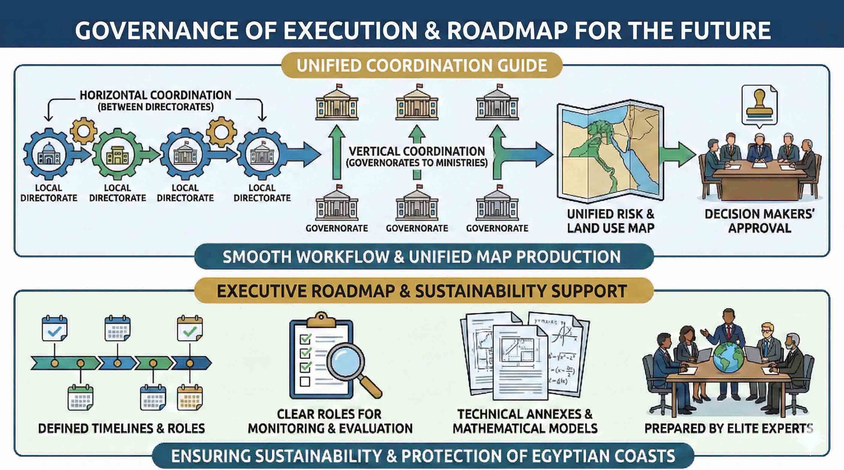
Implementation Governance and the Roadmap for the Future:To ensure a seamless workflow, the plan provides operational guidelines outlining the steps for horizontal coordination (among directorates) and vertical coordination (between governorates and ministries). This process culminates in the production of a unified Risk and Land Use Map, to be submitted to decision-makers for official approval. The system is finalized with an executive roadmap that includes specific timelines and clear roles for Monitoring and Evaluation (M&E). This framework is further supported by technical annexes and mathematical models developed by an elite group of international and national experts to ensure the sustainability and protection of Egypt's coastlines.