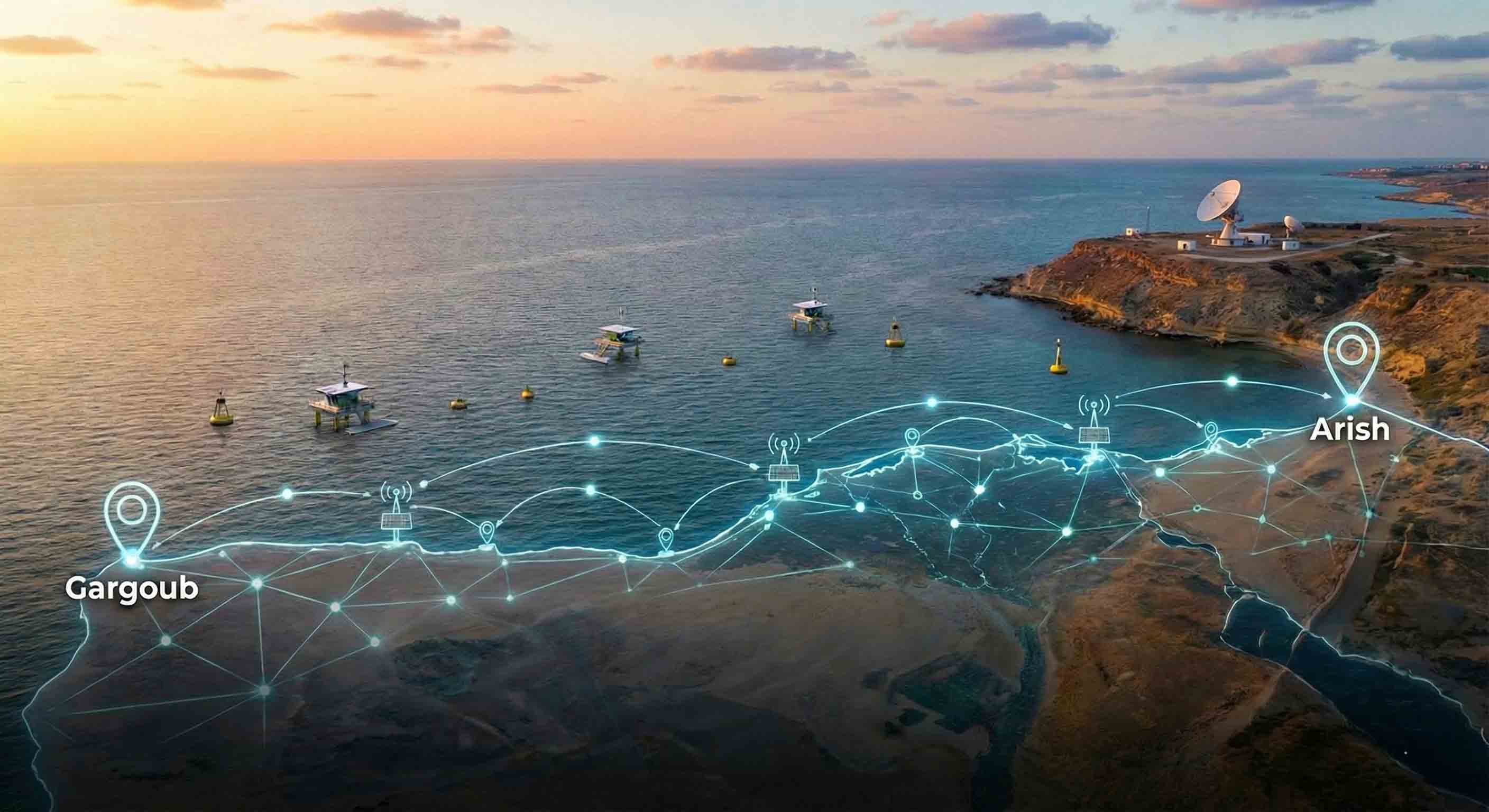
Egypt’s Coastal Information Shield: Launching the first integrated national monitoring system covering the entire 1,200 km Mediterranean coast from Arish to Salum.
Comprehensive Geographic Coverage and Bridging the Data Gap: Egypt has achieved a strategic milestone through the "Enhancing Climate Change Adaptation in the Nile Delta and North Coast of Egypt" project, successfully establishing the first integrated monitoring system that covers the entire Egyptian Mediterranean coastline. This system aims to bridge a significant long-term data gap by providing continuous and representative observations from Arish in the far east to Jarjoub (Matrouh) in the far west. This step serves as the national nucleus for a coastal monitoring system, ensuring that the Egyptian state possesses a precise and comprehensive informational vision of all changes occurring along its northern maritime front.
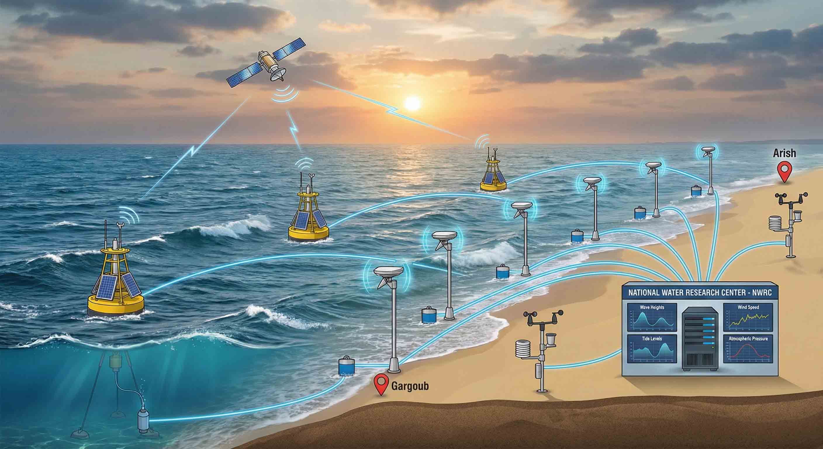
Real-time Sea Level and Meteorological Monitoring: The project's technical infrastructure includes the deployment of 7 advanced sea-level monitoring stations utilizing both pressure and radar technologies. These stations are capable of transmitting data in real-time to the National Water Research Center (NWRC) server and are strategically distributed to cover the entire coastline from Arish in the east to Jarjoub in the west. To ensure high-precision offshore monitoring, the system is reinforced by 3 wave monitoring stations that measure wave intensity and direction at depths of up to 40 meters. Additionally, 4 modern meteorological stations have been integrated with the Egyptian Meteorological Authority (EMA) network, providing full, 24/7 integration in monitoring both marine and atmospheric phenomena.
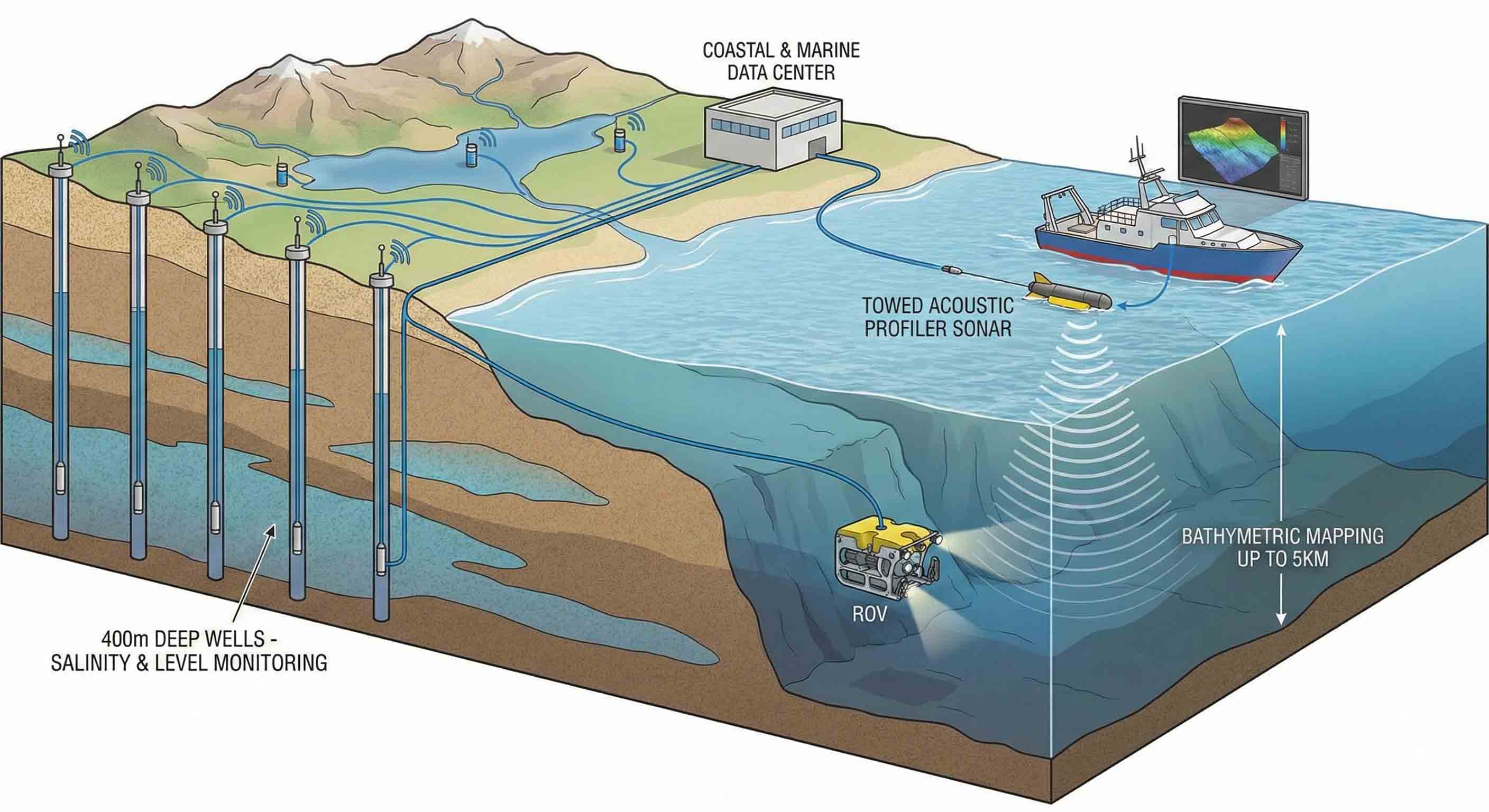
Subsurface Exploration and Groundwater Aquifer Protection: Monitoring was not limited to the surface but extended to include the depths of the sea and coastal groundwater aquifers. Ten observation wells, reaching depths of up to 400 meters, were established to monitor the impact of sea-level rise on groundwater, supported by devices for measuring salinity and water quality in lakes and valleys. Additionally, the system includes advanced echo sounders and specialized inflatable boats to conduct bathymetric surveys and mapping extending up to 5 kilometers offshore. This ensures the monitoring of morphological changes in the seabed along the Mediterranean coastline.
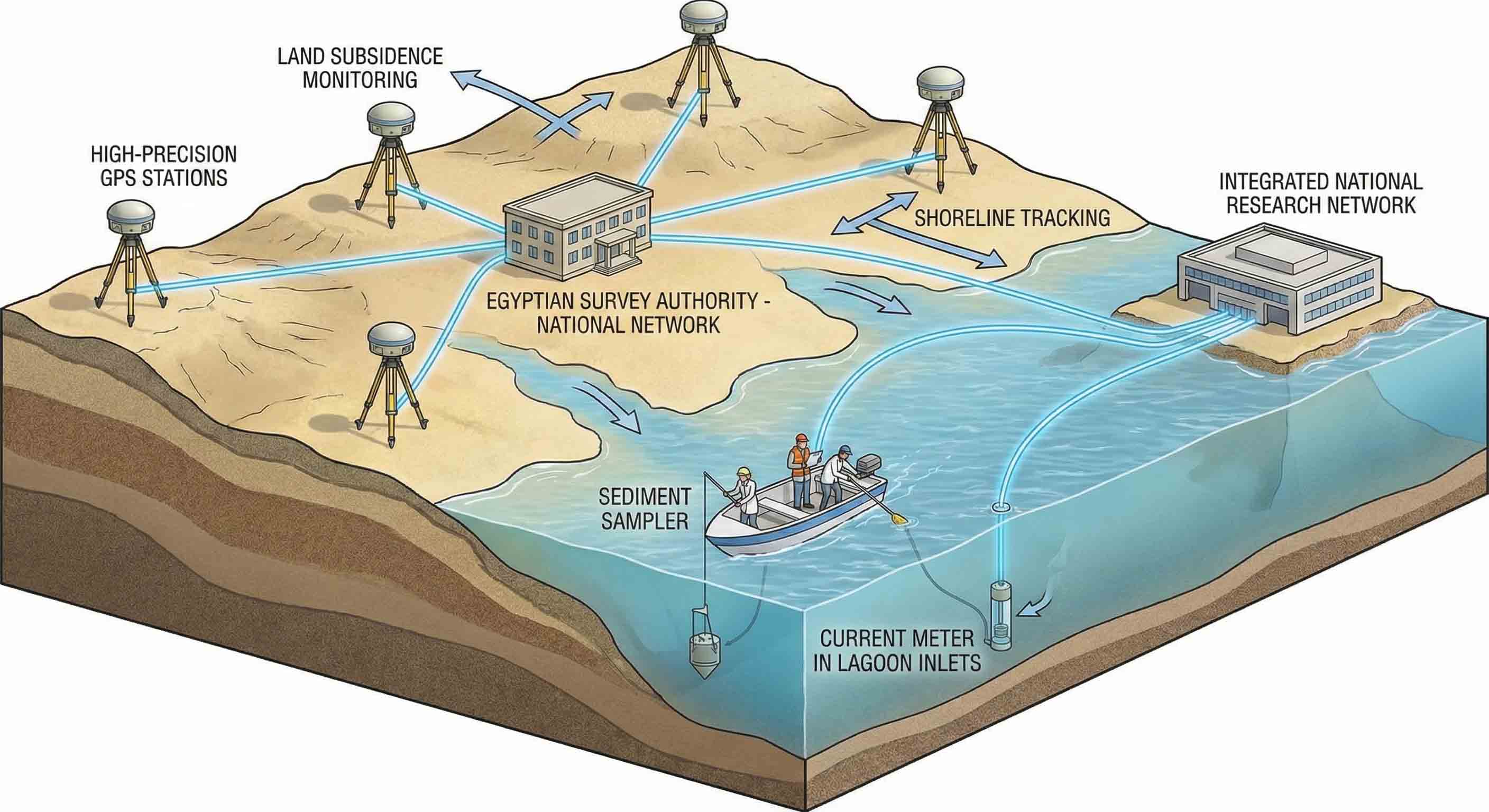
Surveying and Land Subsidence Monitoring: As part of the technical integration, the project provided advanced GPS devices and specialized stations to monitor coastal land subsidence, working in full integration with the national network of the Egyptian General Authority for Survey (ESA). This technology enables ultra-high-precision tracking of the shoreline and the monitoring of any land movements resulting from climate change. Additionally, the system was equipped with marine sediment samplers and current meters for tidal inlets (Bawaghir), transforming this integrated network into a comprehensive research tool that serves all national research institutes.
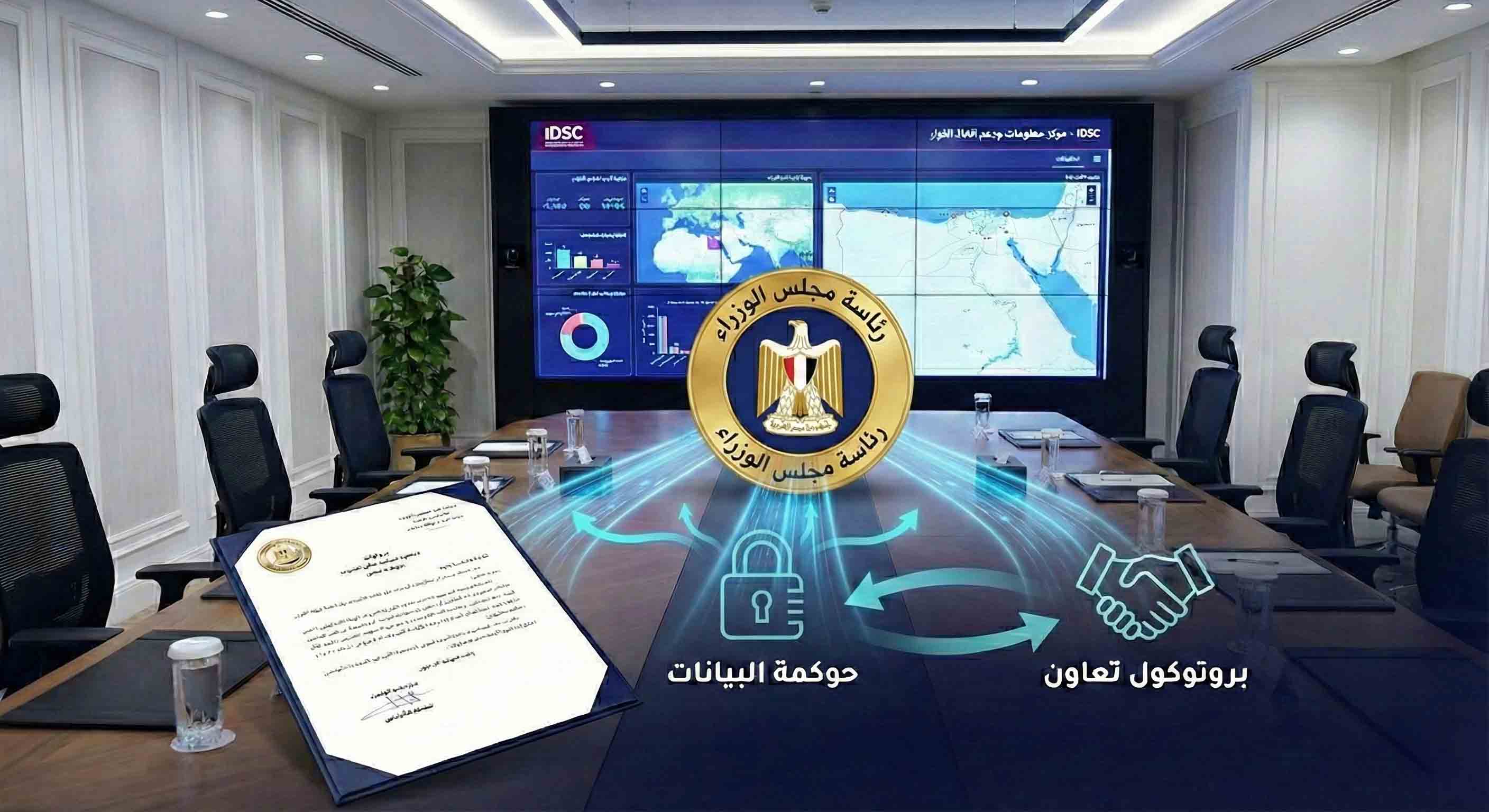
Data Governance and Decision Support: To maximize the benefit from this massive information flow, a formal cooperation protocol for data transfer and exchange was signed among the relevant authorities and ministries. Under this protocol, a comprehensive and updated copy of all observations and data is provided to the Information and Decision Support Center (IDSC) of the Cabinet. This serves as a primary reference supporting the formulation of evidence-based national policies. This step aims to enhance information transparency and unify national efforts to address coastal risks with high efficiency and speed.