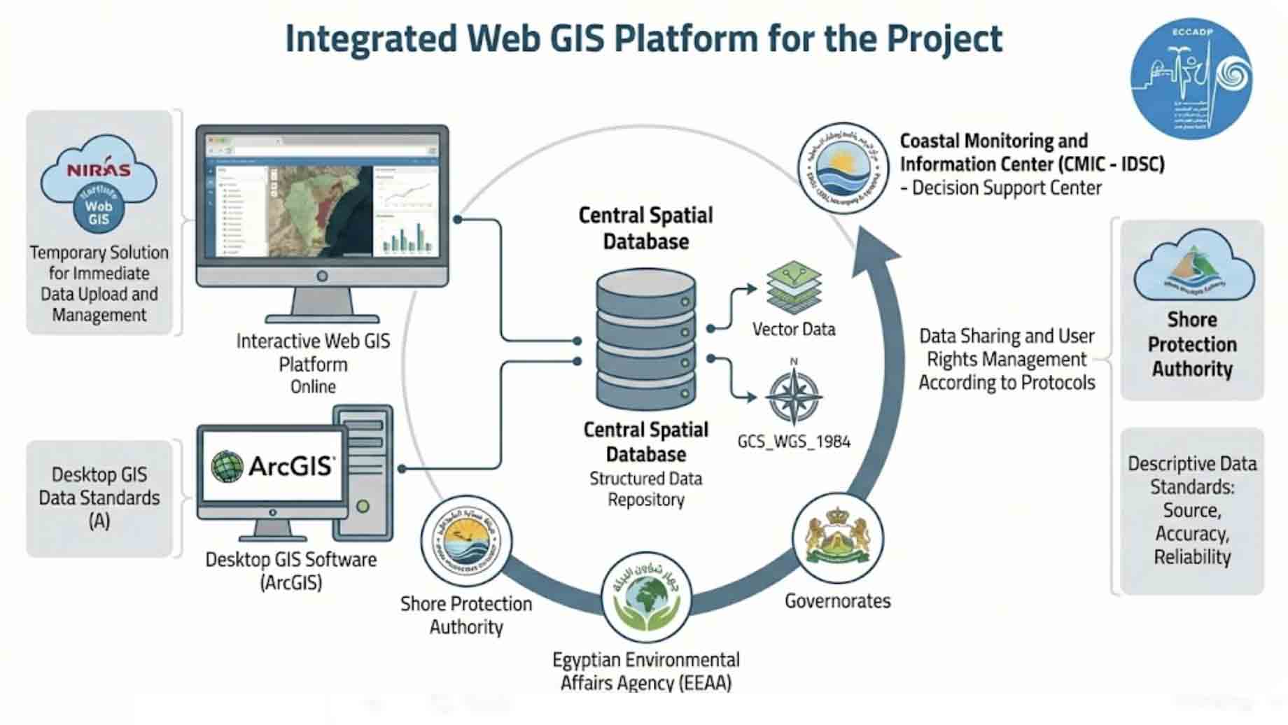
The project utilizes a web-based GIS platform designed as an integrated framework for the collection, management, display, and analysis of spatial data. Technically, the system is anchored by a spatial database that ensures high-performance efficiency, offering system access via web browsers while enabling the use of the same data through supporting desktop GIS software, such as ArcGIS.
During the inception phase, an interim solution utilizing NIRAS KortInfo Web GIS was implemented to ensure immediate data uploading, management, and accessibility for all project stakeholders. A comprehensive geodatabase is currently under development, encompassing the natural, physical, and socio-economic characteristics of the study area. This database supports both Vector and Raster data formats, adhering to rigorous metadata standards—including source, accuracy, reliability, and projection systems—using the GCS_WGS_1984 coordinate system.
The GIS database serves as a structured central data repository. The Coastal Monitoring and Information Center (CMIC)—currently being established in coordination with the Cabinet’s Information and Decision Support Center (IDSC)—will be responsible for its continuous collection and updates. This ensures sustainable data accessibility, supports future planning, and addresses the issue of data fragmentation among agencies. Furthermore, the system facilitates data sharing among various stakeholders, such as the Shore Protection Authority (SPA), the Egyptian Environmental Affairs Agency (EEAA), and the Governorates. Data usage rights and display restrictions are governed by agreed-upon protocols, integrating data from multiple official sources while considering the specific requirements of certain entities that may necessitate additional procedures for data sharing.