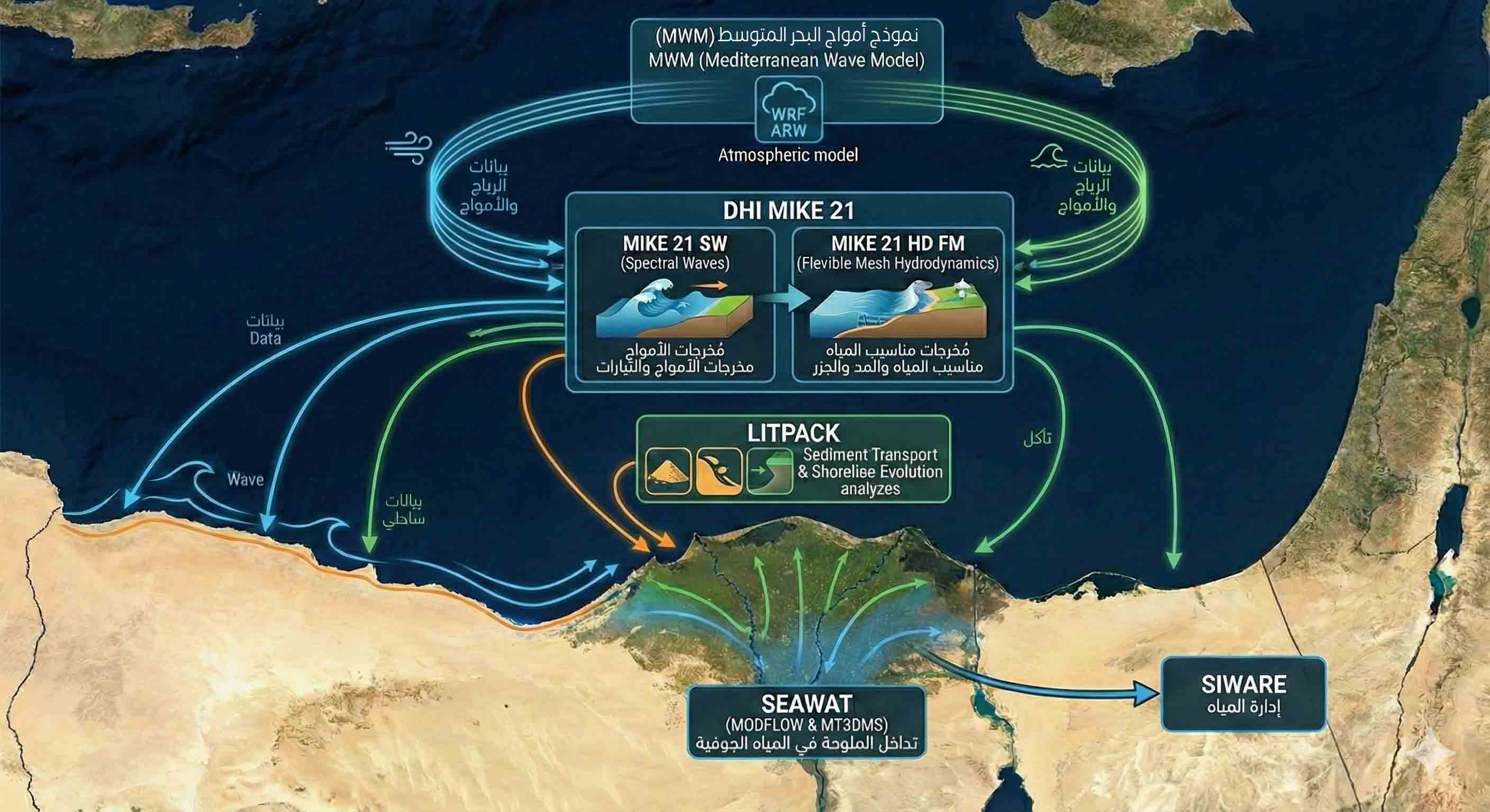
The Integrated Coastal Zone Management (ICZM) plan employs a sophisticated suite of advanced mathematical models to simulate coastal processes and assess climate change risks along Egypt’s North Coast. The modeling framework primarily relies on the DHI MIKE 21 software package; the MIKE 21 SW (Spectral Waves) model is used for detailed wave transformation analysis, while the MIKE 21 HD FM (Hydrodynamics Flexible Mesh) model simulates water levels, tides, and storm surges. T
hese models are supported by the Mediterranean Wind and Wave Model (MWM) system, which utilizes the WRF ARW atmospheric model to provide high-resolution boundary conditions for wind and waves. For morphological analysis, the LITPACK system is employed to calculate sediment transport and predict shoreline evolution. Furthermore, the complex interaction of saltwater intrusion in the Nile Delta aquifers is represented using the SEAWAT model (based on MODFLOW and MT3DMS).
This is linked off-line with the SIWARE model to integrate surface water management and drainage dynamics.